Kenya’s Other Wild Kingdom
On World Oceans Day, a reminder that Kenya’s coast is one of the most layered, most alive, most overlooked places on earth.
Most people, when they think of Kenya, think of the Mara. The elephants moving across the plains. The wildebeest crossing. The big cats. What they tend not to think about — what even many Kenyans tend not to think about — is 536 kilometres of Indian Ocean coastline, and everything living in it, on it, and because of it.
Today is World Oceans Day. This year’s theme is Reimagine. So let’s try.
A coast built from many peoples
The Kenyan coast is not one community. It is a layering of peoples, languages, and histories that have been accumulating for over a thousand years.
The Mijikenda — whose name means ‘the Nine Tribes’ — are the largest indigenous coastal group, comprising nine related but distinct Bantu peoples: the Giriama, Digo, Duruma, Chonyi, Kauma, Jibana, Kambe, Rabai, and Ribe. Each traditionally lived in their own hilltop settlement, known as a kaya, along the ridge running parallel to the coast. The kaya forests are now UNESCO-recognised sacred sites.
Alongside them: the Swahili, an African people who embraced Islam in the 9th century and built one of the longest-lived urban civilisations in sub-Saharan Africa. Their language, Kiswahili, absorbed Arabic, Persian, Portuguese, and Bantu roots over centuries of Indian Ocean trade. Then the Bajuni — a Bantu group concentrated around Mombasa and the northern coast, tracing ancestry from coastal Bantu communities as well as Arab and Persian settlers. Languages spoken along the coast today include Kidigo, Duruma, Kitaveta, Kibajuni, and multiple Mijikenda dialects, in addition to Swahili and English.
The coast was a crossroads long before Europe arrived.
Fort Jesus and the long argument over the harbour
Fort Jesus in Mombasa is the most visible evidence of what the coast meant to the world. Built by the Portuguese between 1593 and 1596 — designed by the Italian architect Giovanni Battista Cairati, its proportions based on Renaissance ideals of the human body — it was constructed to control the port of Mombasa and the trade routes of the Indian Ocean. Gold, ivory, spices, and enslaved people passed through.
Between 1631 and 1875, the fort changed hands at least nine times. Portuguese garrisons, Omani Arab armies, Swahili warriors, and eventually British colonists all held it, lost it, and fought for it again. The Omani Arabs took it in December 1698 after a siege lasting nearly three years, during which the Portuguese garrison was reduced to nine surviving soldiers. The British, when they finally consolidated control, turned it into a prison.
The fort’s walls carry all of it. Portuguese stonework, Quranic inscriptions carved into doorposts by Omani occupants, British-era cells. It is now a UNESCO World Heritage Site and a museum managed by the National Museums of Kenya. No cleaner summary of the coast’s layered history exists.
What lives in the water
Watamu Marine National Park — established in 1968, one of Kenya’s first — sits 300 metres from shore along the central coast, 140 kilometres north of Mombasa. It is a UN-recognised World Biosphere Reserve and holds some of the richest reef ecosystems on earth.
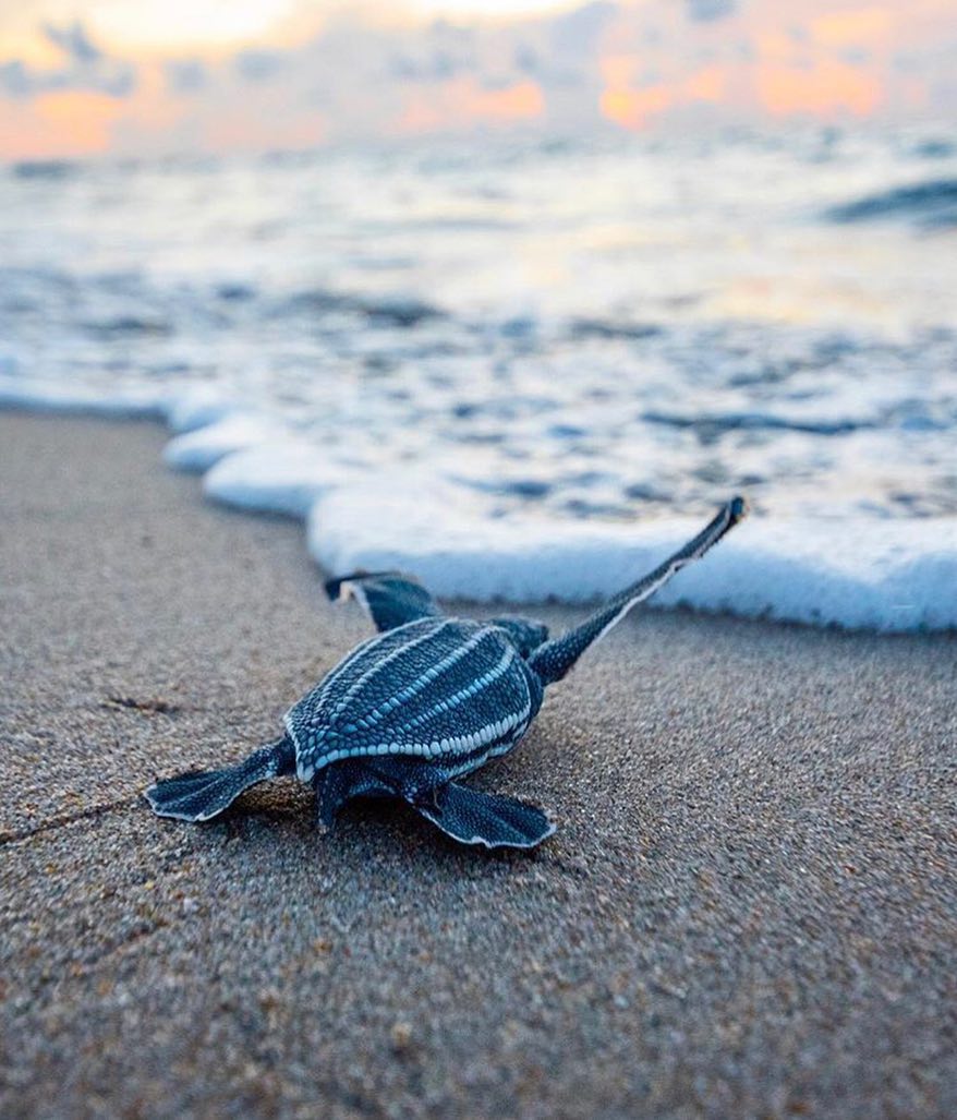
The coral gardens contain over 150 species of hard and soft corals: brain corals, fan corals, sponges. Within them, approximately 600 species of fish — parrotfish, angelfish, groupers, lionfish, snappers, damselfish, moray eels, barracuda. The surrounding marine reserve extends that count to around 1,000 species. Hawksbill, green, leatherback, and olive ridley turtles nest on the beaches. Whale sharks and manta rays move through the blue water beyond the reef. Octopus hunt along the coral ledges. Blue-spotted rays glide through the seagrass.
The Watamu name, in the local language, means ‘land of the sweet people.’ Its reef has been producing white sand — parrotfish digesting coral over millennia — for longer than any human settlement in the area.
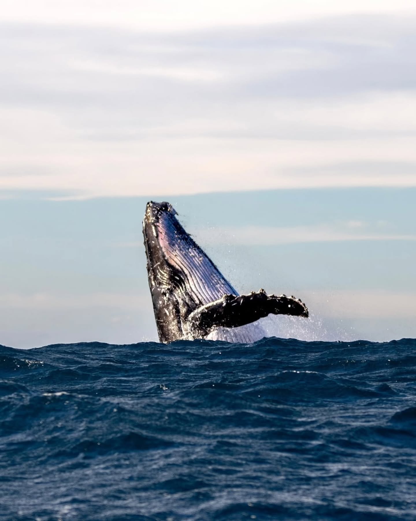
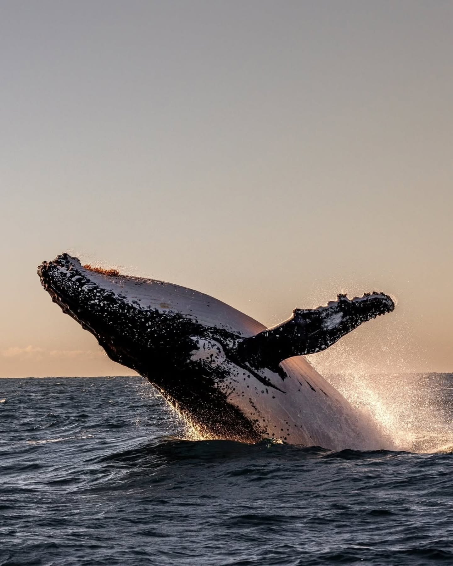
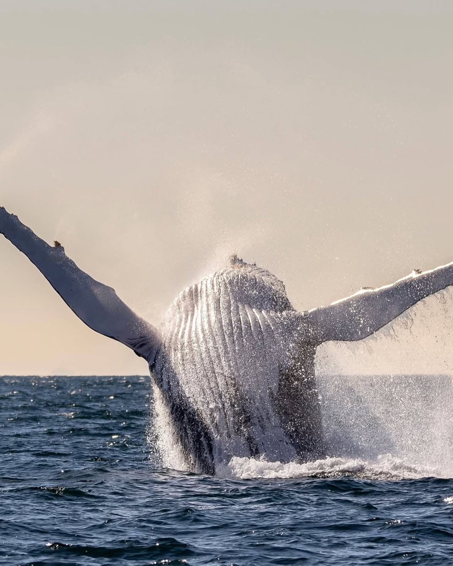
The whales that come every year
Between July and October, humpback whales pass through the Watamu Banks — a large nearshore bank system off the central coast. These are Southern Hemisphere animals, classified by the International Whaling Commission as Breeding Stock C, and they use the Watamu Banks specifically for nursing their calves. The Kenya Marine Mammal Network logs more humpback sightings from Watamu than from any other location in Kenya.
Year-round, Indo-Pacific bottlenose dolphins are resident in the marine park — a long-term photo-identification programme running since 2010 has documented 141 individual animals, with mothers and calves regularly observed in the nearshore zone. Indian Ocean humpback dolphins, an endangered species, are also present.

And then there are the orcas. Killer whales in the tropical waters of the northern Indian Ocean — which includes the Kenyan coast — are among the least understood cetaceans in the world. Sightings are rare and largely offshore, which is precisely why the Northern Indian Ocean Killer Whale Alliance exists: a collaborative network of researchers, divers, and game fishers pooling sightings to build a photo-ID catalogue across the region. What moves through Kenya’s deep water, and when, is still largely unknown.
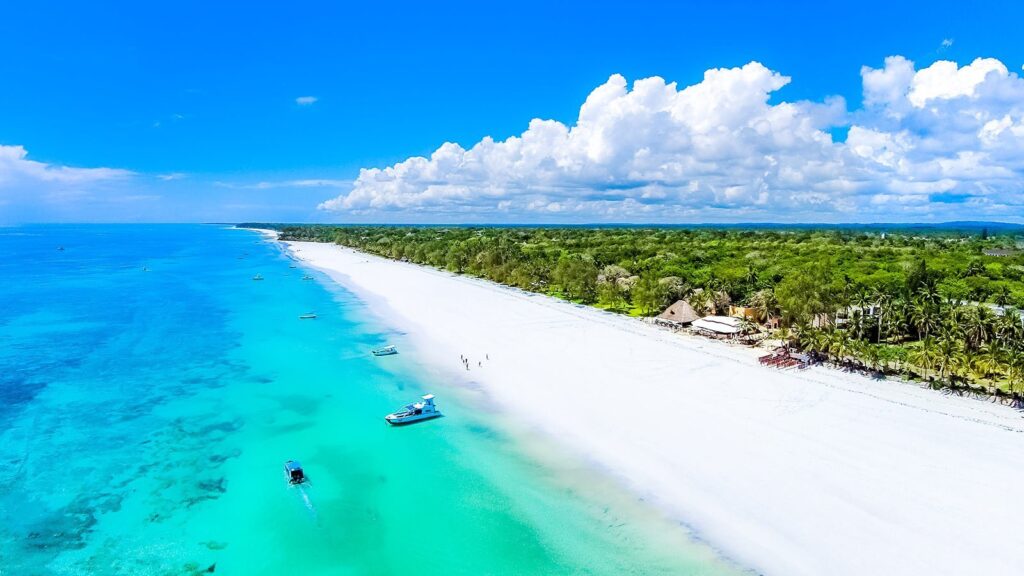
The towns along the edge
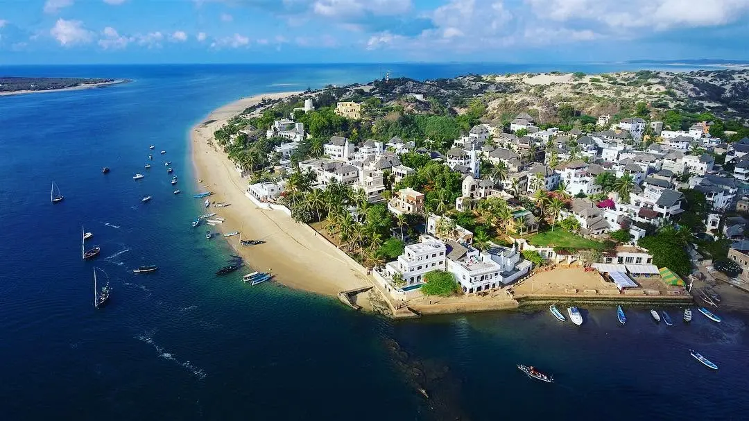
The coast runs from Shimoni and Wasini Island in the south — coral rag forest, dhow trips, whale shark encounters — north through Diani and Galu Beach, up to Mombasa, the island city, with its Old Town, its dhow harbour, and Fort Jesus watching over the creek. North of Mombasa: Kilifi, where the creek opens into one of the most beautiful natural harbours on the east African coast. Then Watamu, then Malindi — the oldest continuously inhabited town on the Kenyan coast, with a Portuguese chapel built in 1542 still standing near the seafront. Further north still, Lamu: a UNESCO World Heritage town, car-free, its streets too narrow for anything wider than a donkey, its architecture a living record of Swahili, Arab, and Indian influence over several centuries.
Each of these places is different. Each is the same coast.

Why it matters from Nairobi
Kenya committed, along with the rest of the world, to protecting 30% of its ocean by 2030. The High Seas Treaty — formally known as the Biodiversity Beyond National Jurisdiction agreement — entered into force in January 2026 after reaching its 60-nation ratification threshold. What happens next, in terms of actual marine protection, is the question.
Nairobi is where those decisions get made. The city is landlocked, but it is not offshore from this conversation. What the reef looks like in 20 years, whether the humpbacks keep coming, whether the orca sightings remain sparse or disappear entirely — some of that will be decided in this city, by people who may never have stood on the Watamu sand.
That is the Reimagine the UN is asking for. Not just a new relationship with the ocean. A new understanding of who is responsible for it.
#WorldOceansDay #KenyaCoast #Watamu #Mombasa #Lamu #MarineLife #OceanDay2026 #inNairobi